Log In
/-79.80651140213,32.787896876619,12/500x250?access_token=pk.eyJ1Ijoid2F0ZXJ3YXlndWlkZSIsImEiOiJGRmM1RDdzIn0.Wya5yV5QEqbz0-fct8zyIA)
SC: Isle of Palms, shoaling MM 460 - 461
- Date Reported: Mar 13, 2025
- Reporter: Bob423
- Source: User
- Description:
Update: Isle of Palms has been dredged at MM 460.3!
The Bob423 track has been updated to go straight through the shallow spot near MM 460. There is no longer the need to take the red dotted line loop south.
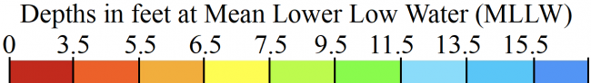
The chart below is an advanced copy of the latest USACE survey. It's not yet in Aqua Map. The Bob423 track is now down the middle of the newly dredged channel for 12 MLLW.

https://bobicw.blogspot.com/p/bob423-long-tracks.html
There are more shoals to avoid farther on at MM 461.1. Follow the Bob423 track for 6.4 MLLW as of 11/8/2024

The final shoal before the Ben Sawyer Swing Bridge (going south) at MM 461.5 is shown. In this case, the best path is right in the middle of the channel for 6.9 MLLW as of 11/8/2024

USACE = US Army Corps of Engineers
ATONs = Aids TO Navigation such as buoys and daymarks
Aqua Map = a navigation app for Apple and Android devices
Bob423 Long Track = blue dotted line
How to download tracks - Lat / Lon: N 32° 47.274' / W 079° 48.391'
5 Boater Comments
-
Comment by: Mark Green, Green Voyage, on Dec 18, 2024
Vessel Type: Sail
LOA: 38'
Draft: 5.5'Ran hard aground on the blue track 2 hours before low tide. 5.5 draft. MM 460.4. Take the detour!!
View location on the Waterway Guide Explorer
-
Comment by: Hubert Hopkins on Nov 1, 2024
Vessel Type: Power
LOA: 42'
Draft: 4.0'There are two temporary Green buoys 117B and 117C just south of marker 117A at mile 460.3. They are very close to each other. I passed to the north of those and had 6' depth above MLLW. This follows the Bob423 track pretty closely.
My passage was exactly at low tide with 1' above MLLW so it was very shallow.
I believe that the "detour" would be less stress for some if the dredge is not blocking the channel. They were not working the day I went through.View location on the Waterway Guide Explorer
-
Comment by: Rick Vicars on May 26, 2024
Vessel Type: Power
LOA: 45'
Draft: 5.0'5-16-24 No less than 8 ft (low tide) taking the alternate route avoiding the AICW shoaling.
View location on the Waterway Guide Explorer
-
Comment by: Elizabeth Lenoski, Tranquilo, on May 15, 2024
Vessel Type: Sail
LOA: 36'
Draft: 5.0'Came through at 3' tide northbound. Bob alt route had no less than 11' of water. Dredging equipment is set up just south of the bridge and more was being brought in as we passed. Dredge is near center but plenty of space to get by.
View location on the Waterway Guide Explorer
-
Comment by: Teresa Scott on May 6, 2024
Vessel Type: Sail
LOA: 40'
Draft: 5.5'Came through at low tide and used the detour. Lowest we saw was 7.8. A bit nerve wracking especially with a large MV who impatiently had to pass during this.
View location on the Waterway Guide Explorer


