The Exumas are for many people synonymous with The Bahamas. It is a chain of over 350 islands ranging in size from deserted postage-stamp sized pieces of rock with a few trees to the 37-mile long Great Exuma Island, which is the largest island and home to several thriving communities. 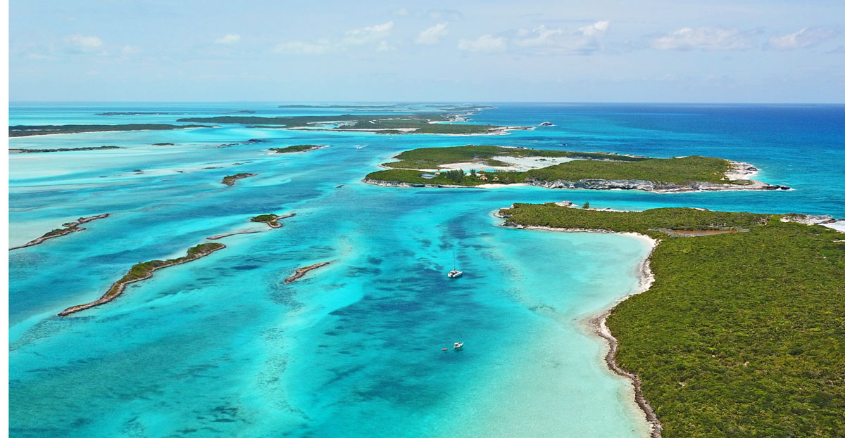
Oriented along a northwest & southeast axis, the over 120 nm long chain of islands stretching from Ship Channel Cay in the north to White Cay in the south, provides cruising options for vessels of all drafts and LOA. The cays themselves for a natural breakwater to protect vessels on the Great Bahama Bank from the ocean swells that are common in Exuma Sound.
While there are many areas of shallow water, there are work around strategies for most vessels provided crews are adept at reading the water and boat handling in close quarters. When navigating in the Exumas there are routes that can accommodate most drafts, so deeper drafted vessels need not fear missing out.
In the middle of the chain is the world famous Warderick Wells, part of the Exuma Cays Land & Sea Park. Managed by the Bahamas National Trust as a National Park, it is a protected zone renowned for its crystal-clear waters, flourishing marine eco-system and majestic views. Within the park there are snorkeling and diving opportunities for all skill levels that are not to be missed.
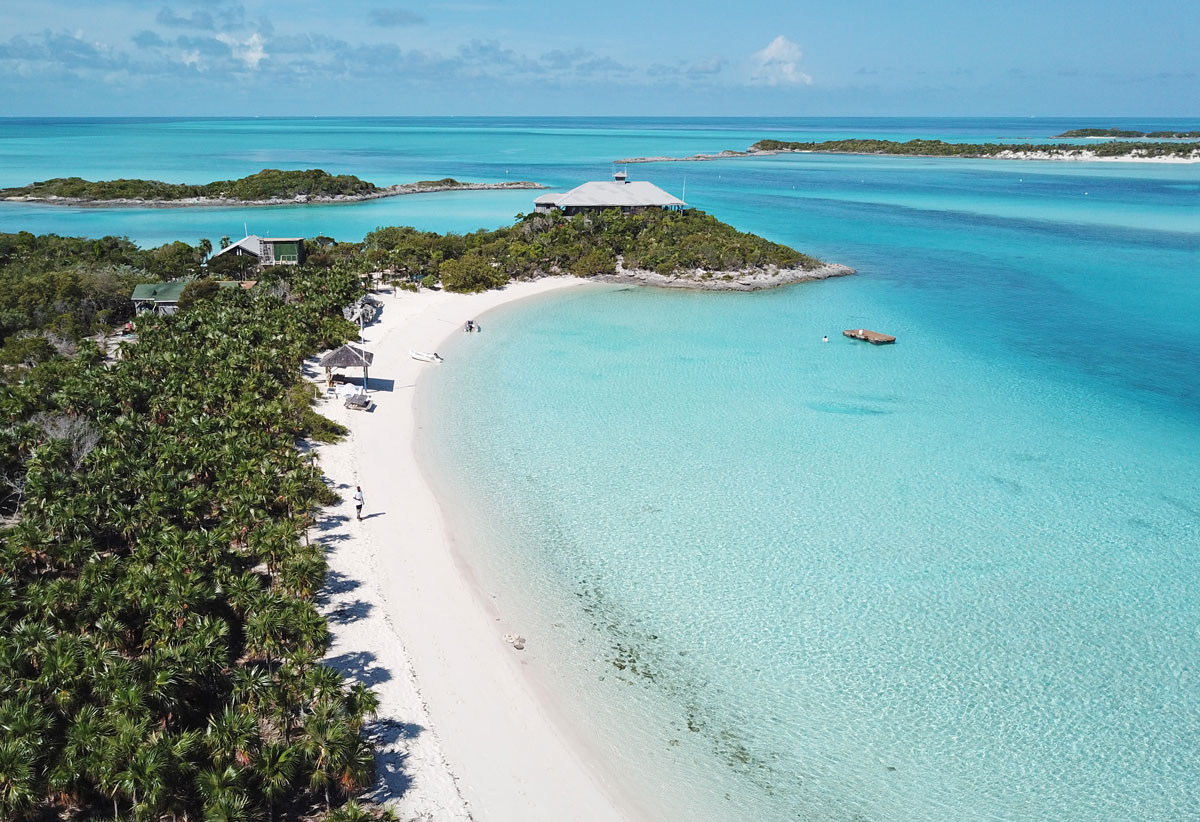
Most of the Exumas anchorages are close together and, for those needing shore support, there are several well spaced marinas that can support vessels of all sizes with dockage and fuel. It is an area where you can be in an affordable 5-star marina one day and within an hour be in a deserted, pristine anchorage surrounded by white sand beaches.
Regardless of your boating skills or your level of self-sufficiency the Exumas are accessible for all, and it is not uncommon for <30' sailboats to be sharing an anchorage with a 150'+ megayacht.
Strategies for visiting the Exumas
Each island in the chain has its charms and almost everybody will have a list of personal favorites, but to only visit the islands on someone else's list is to miss a wonderful opportunity to discover something new. Almost every island has a protected anchorage, so it is possible to spend part of the day exploring and part of the day traveling to make measured but steady progress down the chain.
For example, you could be snorkeling off Lobster Cay in the morning and be in the Normans Cay Marina or a nearby anchorage by dinnertime after traveling a distance of only 6nm. At that pace you can start at Ship Channel Cay in the north and reach Georgetown in about 2 weeks without feeling rushed.
For those who are in more of hurry or who want to concentrate on a more distant part of the chain, it is possible to navigate either in the deep water of Exuma Sound or along established largely hazard-free routes on the Great Bahama Bank. In settled weather conditions most boats can travel the entire length of the Exumas in 1 or 2 days without resorting to movement after dark, which is generally not recommended. It would be a loss to rush through the Exumas.
Sailors will note that the prevailing winds in the Exumas tend to be easterly in the winter and more southeasterly later in the spring, making it easier to sail north along the chain than southwards. Therefore, a valid strategy is to cover some or all the route southbound under power with the objective of reaching your southernmost destination quickly and then taking advantage of the more favorable winds to gunkhole your way back.
For those who are chartering out of Nassau, the power south and sail back strategy is a good one because it is the most flexible in terms of how many islands you can visit within a finite period. While weather is always the determining factor it is usually realistic to expect that a one-week round trip between Nassau and Staniel Cay is possible if two days are allotted for south bound travel under power with the remaining time used for a leisurely return under a combination of sail or power as time and weather permits.
Quickly or slowly, under power or under sail, deep draft or surface skimming there is something for everyone and every type of vessel in the Exumas.
New Providence to the Exumas
The most common approach to the Exumas begins in New Providence and traverses a portion of the Great Bahama Bank.
Most charts show the paths between the east or west ends of New Providence Island towards the Ship Channel Cay to Highborne Cay blocked by a minefield of coral heads waiting to sink your boat. The reality is that most of the heads are low profile only extending 3-4' above the bottom which means that most vessels of up to 6' draft can pass directly over without issue, even at low tide. It is true that there are a few coral heads in the area larger than others, but they are seen as obvious dark spots and are easily avoided by an alert skipper.

The Yellow Bank and the White Bank are two small areas of shallow water but they are well marked on the charts and are easily avoided if you are aware of their presence. Vessels traveling on a direct route between Porgee Rock and either Ship Channel or Highborne Cays will not be affected by the two banks as they lay well to the west of the rhumb line. They are more of a concern for sailors traveling between Clifton Bay on the west end of New Providence and the Exumas. If you are coming from this direction, once again, awareness is your best defense.
Much of the urban legend about the difficulties of transiting the Yellow and White Banks stems from the days before GPS when even expert navigators could have difficulty dead reckoning their way across the banks with sufficient accuracy to compensate for the currents and tides.
The water on the banks becomes shallower the farther north you lie, and the number of coral heads increases, so a good plan is to track for Highborne Cay until well south of the area of coral heads before turning towards Ship Channel or Allan's Cay. For this reason it is not recommended passing through this area at night or in conditions of poor visibility, at least not until you have verified your own tracks through safe water.
Navigation through this area must be treated with respect, but it is not as complex as the charts would imply. Nevertheless, it is not a surprise that many visitors begin their Exumas experience at Highborne rather than the cays farther north.
Eleuthera and Cat Island to The Exumas
Exuma Sound is, for all intents and purposes, open ocean and should be treated as such. The most important part about traveling across Exuma Sound is the effect of the weather and tide on the cuts that must be traversed. In prevailing easterly conditions both Eleuthera and Cat Island create a lee that will attenuate the prevailing winds and flatten out the seas for several miles. Once out of the lee, however, the full force of mother nature will be felt and the smooth 17 knot beam reach in 2–3-foot seas can quickly become a rip roaring +20 with higher seas.
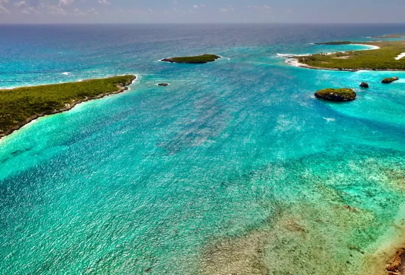
While flying along in +20 knot winds can be exhilarating in open water, it is an entirely different situation when faced with passing through a narrow inlet in turbulent conditions. Fortunately the navigable cuts in the Exumas are deep, which eliminates most concerns with draft, but they act as nozzles where the waters of the banks squirt out into Exuma Sound on an ebb tide and reverse on the flood. When planning a trip be sure to account for the wind and tides at your chosen entry point onto the banks because the force of the water against an unfavorable wind can be frightening.
While all cuts between Exuma Sound and the banks must be treated with respect, Ship Channel Cay in the north and Wide Opening, just north of Warderick Wells, provide the least turbulent passages. If conditions at your planned inlet are worse than forecast upon arrival, deviating to the closest of these two cuts should be considered.
Learn more about cruising The Exumas and The Bahamas with Waterway Guide Bahamas Land & Sea and the Waterway Guide Bahamas Edition, available in the Ship Store.


- 4,000 Marinas
- Thousands of anchorages
- Updated Charts
- Mile-by-Mile Navigation
- Highlighted Alerts & Cautions
- Full-Color Aerial Photographs

The Waterway Guide App Makes it easy to leave reviews, use our explorer, and view waterway guide materials all on the go!