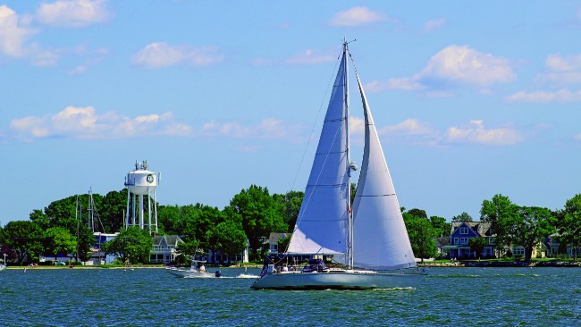
Our friends and families have been doing Chesapeake Bay loops forever, but we didn't call them that. We had five or six destinations in mind and took off, knowing that eventually we would make it back or leave the boat and return as our schedules permitted for the trip home. With the popularity of loops (America's Great Loop, the Triangle Loop, Florida Loop, and more) we're sharing a proven Chesapeake Bay itinerary that most anyone can embark upon with a sound vessel, charts, basic navigation skills and a cruising guide.
But be forewarned. If on a sailboat, or even a comfortable trawler or heavy cruising boat, this Chesapeake Bay loop will put you at odds with some type of weather system about every five or six days. It's big water out there. In the summer the prospect of making way in one direction or the other is a bit less troublesome, but there should always be some meteorological considerations in your planning. Cold fronts, thunderstorms and afternoon sea breezes abound year-round, which means you may not be able to always go the direction you want, when you want.
 The good news is that you can dodge, skip, hunker down and gunkhole your way to adventure and comfort if you pay attention to weather and tide and plan accordingly. If you are not on a schedule, then you certainly can choose a nice route up one side of the Bay and down the other as weather and wind align with your comfort zone. Or you can zig-zag your way up or down as conditions impact your direction of travel, which makes your travel less of a loop and more of a meander, but still makes for a great trip.
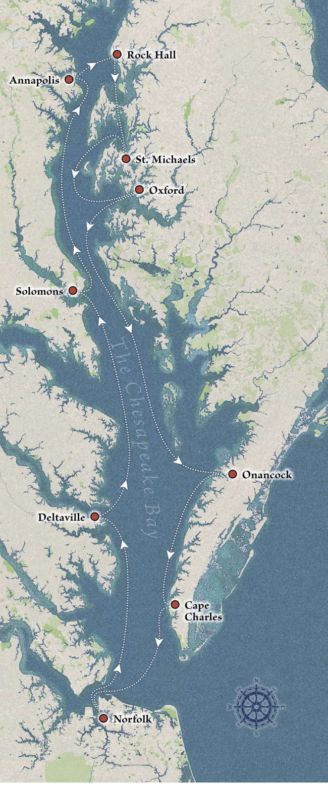
The recommended Chesapeake Bay loop that we've taken over the years starts and ends in the same place. You, of course, can start anywhere and make the loop your own. And add other locations as you wish. This is a trip that will keep you on the move and exploring throughout the peak boating season, which runs from mid-May to mid-October, give or take a couple of weeks on each end. And the stops are all recommended based on our experiences.
If you have all the time in the world, this is a three- to four-week itinerary on your own boat. You can also charter in many of these locations if you want to explore locally. If you have a lifetime to explore you can sail and cruise the Chesapeake Bay and never anchor or stay in the same place twice. There are countless coves and creeks and anchorages in the 11,500+ miles of shoreline. But for a manageable and comfortable adventure consider the following routes. Timings are based on an average speed of 6 knots, so the number of hours and days will vary based on your vessel's speed. If you're moving fast you can pass up some of the stops and complete the trip with fewer destinations.
Norfolk to Deltaville, VA – 50 Miles
Starting somewhere in the Elizabeth River at Mile Zero of the Atlantic Intracoastal Waterway, you can make Deltaville in a few hours or take all day, depending on boat speed. When the days are longer in late spring, summer and early fall, this is an easy trip. If you are not in a hurry, or get a late start, you can duck into Mobjack Bay and choose any number of anchorages or a few small marinas up the creeks and then complete the trip to Deltaville when you're ready. Once past New Point Comfort there are few options for coming ashore until you get to Deltaville, where you can find a marina or anchor in several nice locations on either side of the peninsula. Deltaville is a small town with several restaurants, a nice museum and plenty of service facilities and supplies. Be prepared to ask for transportation from the marina if you need provisions or want to dine out. Walking is not easy from the waterfronts on either side of town. But chances are you will find someone to give you a ride. It's that kind of town.
Deltaville, VA to Solomons, MD – 56 or 62 Miles
Depending on which side of Deltaville you stay will affect how many miles and hours to Solomons, MD. Either way, this is another day's journey at 5-6 knots. If you have time or need to duck in, the Great Wicomico River offers options for exploring and anchoring or docking in Reedville, VA.
You will cross the mouth of the Potomac River on this leg. Wind and tide can be your friend or can challenge you. Wind against tide will build swells and chop. Move farther out into the Bay and the effects of currents and eddies from the Potomac will usually be less. Time your passage around slack tide and high pressure overhead for an easy, flatwater transit across the Potomac.
After you transit the mouth of the Potomac River, you may see U.S. Navy patrol boats in the water as you approach the Patuxent River. Monitor your radio on VHF Channel 16 closely. There is a restricted area that serves as a practice run for jets on mock bombing missions along this stretch of coastline off Naval Air Station Patuxent River. You will see the target in the water, and it's on your charts. If an exercise is scheduled or in progress, you will be asked to move east away from the restricted area and continue your southbound or northbound transit.
You are usually directed to go east of buoy "72A," which is 6 miles from the shoreline of the naval facility. Most vessels don't travel that far away from the western shoreline as they move north and south, so be prepared to alter course east if requested. As you head north and pass "72B" you can start a slow turn NW and begin your approach to Cedar Point, which marks the southern end of the mouth of the Patuxent River. By then you are clearing the restricted area. There are two routes into Solomons, one close to the northern shore and the other in the middle of the river. I prefer to choose the route in the middle, avoid the shoal to starboard and look for "R2."
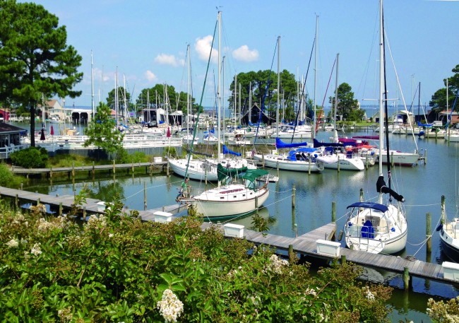
It may be a little confusing as you get close to town with boats and masts in front of you, but just follow the markers and you will clear a little round island, keeping it to port as you go straight toward Back Creek for marinas and an anchorage. Or you may choose to turn hard right for Mill Creek and a find nice spot to anchor. To the left of the little island are a few marinas and another anchorage. Go slow. Look at your chart and you will figure it out. Solomons is well protected and has plenty of facilities, restaurants and museums to keep your visit interesting. Anchor out or take a slip. It's a great town.
Solomons to Annapolis, MD – 50 Miles
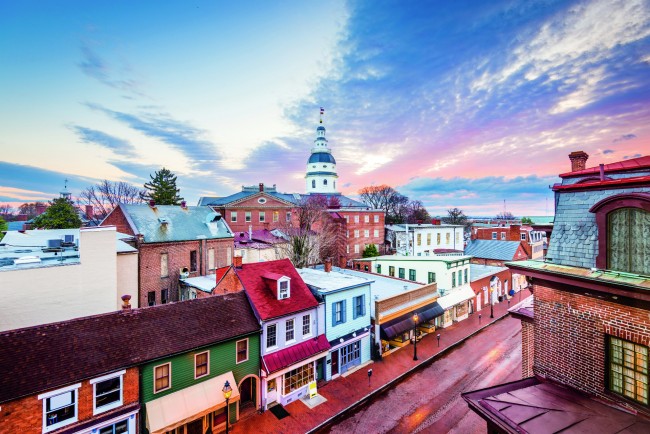
Another day's trip north up the western shore of the Bay gets you to Annapolis. The mooring field in Annapolis harbor is first come, first served, but there is a fee and payment is made easily over the phone. There are plenty of marinas, but always call ahead. Home of the U.S. Naval Academy and the capital of Maryland, complete with a beautiful capitol dome, the city is a favorite for all boaters. Spend a few days or a few weeks. The city stretches uphill from the harbor, and everything is within walking distance of most marinas on Spa Creek and the south side of Back Creek, which is the neighborhood of Eastport. A water taxi service operates beginning in May of the year and can get you either off your boat if on a mooring or anchored or pick you up from regular stops at marinas. Remember that the United States Powerboat and Sailboat Shows are the first two weeks in October each year. Dockage is at a premium then, but it's a good time to visit if you want the experience of thousands of enthusiasts, hundreds of boats and all things nautical from the numerous exhibitors.
Annapolis to Rock Hall, MD – 15 Miles
Crossing the Bay from west to east, you're now on the Eastern Shore, also called the Delmarva Peninsula (made up of Delaware, Maryland and Virginia). The short trip to Rock Hall puts you in a nice little community away from the hustle of Annapolis. Anchorages and marinas are plentiful. And maybe it's time to come off the boat and spend a night or two in a B&B. There are several to choose from, as there are in almost all of the stops along this loop.
Rock Hall to St. Michaels, MD – 35 Miles or 20 Miles
The route you select will determine distance traveled on this stretch. You can go either south through Kent Narrows or around Kent Island. If you go through Kent Narrows, currents and mast height are considerations as is a restricted bridge. The current can run up to 1.5 knots through the Narrows, so be ready to manage your throttle and gears while waiting on the bridge to open if you choose that direction. Confirm the bridge schedule for openings and remember that vessels traveling with the current should be given the courtesy of transiting the opening first. The route outside and around Kent Island puts you in open water and on a circuitous route into the Miles River. St. Michaels is one of the best towns on Chesapeake Bay due to its protected location, the highly rated Chesapeake Bay Maritime Museum (CBMM) and local restaurants and shops. Watch the markers and navigate accordingly as there are some turns and markers that you don't want to miss in the Miles River. Everything in town is easy walking distance from the marinas and docks. Call ahead for reservations during peak season. And check the calendar at the CBMM for its festivals and programs so you can time your visit accordingly.
St. Michaels to Oxford, MD – 36 Miles

As you head south down the Bay you will turn E and then N into the Tred Avon River, then E again into Town Creek for a visit to Oxford, a wonderful little waterfront town with history, plenty of marinas to put you up for the night and several B&Bs if you want to get off the boat. There are also plenty of places to drop the hook for the night. There are a few restaurants, a museum and a small market in town. If you don't have a bicycle aboard your boat, call ahead to find out which marina is closest to where you may want to go. The stop in Oxford will not save you much time or distance because it's 95 miles from St. Michaels directly to Onancock and 80+ miles from Oxford. But Oxford is a good stopover after departing St. Michaels if your weather window is small, or you simply want to explore and take your time to the next destination.
 Oxford, MD to Onancock, VA – 88 miles via Hooper's Strait / 81 miles via the Bay's Center Channel
On this leg the size of the Chesapeake Bay becomes evident as you will soon see that you are a long way from anywhere with few places to stop for fuel or provisions. The eastern side of the Bay along this stretch is sparsely populated, wide open and shallow in many areas, even long distances from shore. Tangier and Pocomoke Sounds to the east are large bodies of water. Chesapeake Bay is 26 nm wide here and a wind fetch from any direction can contribute to your discomfort if it's blowing above 15 knots.
Big sailboats, of course, will find such conditions perfect unless they have to beat into a wind from SE through SW. This is a long leg, so an overnight anchorage at Hoopersville is recommended for slow boats, which will make the completion of your trip a 45-mile run. Or you can tuck into Slaughter's Creek Marina on Taylor's Island for a 60-mile run. Tangier and Smith Islands are also options, as is Crisfield, MD, and farther up the river to Pocomoke City, but facilities, access and amenities are sparse at these locations. Do your research and determine whether you want to add these locations to your itinerary. We've stayed at them all and while they can be charming options, they do not make our list of top destinations for dining or provisions. But any port will do in a storm.
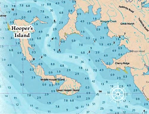 Navigation Note: As you chart your course, you will see that it's possible to go east through Hooper Strait between Bishops Head and Bloodsworth Island and run south behind Smith Island and Tangier Island. The trip will be about 10 miles longer this way, but it may be more sheltered from any wind NE through SE.
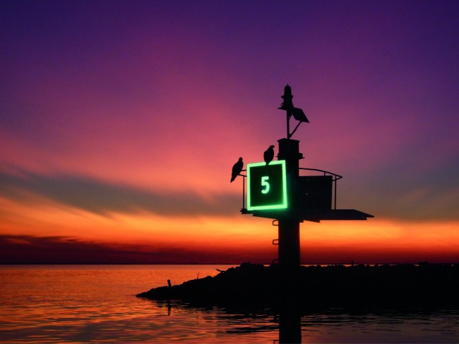
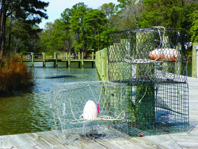
There's plenty of water in the channels. The names of locations are best found in NOAA charts, as many of the mobile navigation apps do not have these details. Crab pot floats dot the bay and rivers and creeks.
Learn how to dodge them. They are not normally placed in marked channels but as you get towards anchorages and in shallow water, they become quite obvious.
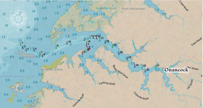
Once you get to Onancock you can breathe a long sigh of relief. It's a well-protected run 6 miles up the creek to town. Be sure to mind the markers and depth gauge if you draw over 4 feet. The town is delightful, with plenty of little restaurants and shops to keep you entertained for a few days. All are within walking distance of the waterfront.
Onancock to Cape Charles, VA – 42 Miles
Heading south to Cape Charles is another stretch with little in the way of options for stopping or provisioning. But the short hop is an easy trip, and you are in the lee of the Eastern Shore if the wind is coming from NE through SE. Elevation of the shore is low but provides some relief close in. The Bay is wide here, so mind the weather and strong winds from N, W and through S. Sailors may want to move toward the middle of the Bay and use the winds to their advantage. Once abeam of Cape Charles when southbound, you will need to continue south 2 more miles before turning NE and then back N in order to get across the reef, past the breakwater structures and into the channel. There are range markers to keep you aligned for both channels. Whether you're going into the Cape Charles Town Harbor or to the north of town and turning east into King's Creek to the marina there, remain between the daymarkers. King's Creek is a bit shallow in places so contact the marina for guidance. Cape Charles is a new favorite destination on the lower Bay for its breweries, pubs, shops, restaurants and a wide bay beach with nice sunsets not easily seen on the east coast. You can spend a week here exploring, visiting other boaters and just relaxing.
Cape Charles to Norfolk, VA – 30 Miles
Crossing back across the Bay to home port is an easy transit but pick your weather window carefully. You are at the mouth of the Chesapeake; it's wide here and when you get to Hampton Roads harbor, there may be 2 knots of ebb tide coming out of the James River, an inbound freighter making 6 knots and slowing, and a submarine or carrier with escorts leaving the naval base. Pay attention and be prepared. We've been rolled by a cargo ship's 5-foot wake and hailed by U.S. Naval Security for getting too close to a military vessel. But once inside the Elizabeth River or up the James River, you have plenty of options for anchorages, marinas and places to visit in Hampton, Suffolk, Norfolk, Portsmouth and Chesapeake, all of which have waterfront access and accommodations for vessels of all sizes and shapes.
Weather Considerations on the Bay

Like all large bodies of water, Chesapeake Bay can beat you up. Considered shallow at 21 feet on average, the Bay's character can change in a matter of minutes. Summer thunderstorms and passing cold fronts any time of year will whip up a frenzy of chop, swells and waves that–in all but the largest of vessels–can make you wish you were at the dock. Weather changes occur primarily west to east in the northern hemisphere and as the systems move through, or lift up or down across the region, winds shift directions, increase or subside. Watching these movements and systems is important when boating on Chesapeake Bay. For my comfort, I plan powerboat trips with high pressure on top of me. For sailboats, I can be a little riskier and use the passing fronts and tight gradients of wind differences to put a "bone in her teeth" and fill out the sails.
The important factor is timing and awareness of wind speeds and direction. We recommend listening to the National Oceanic and Atmospheric Administration's (NOAA) marine forecasts and assessing their various other products to arrive at a decision of when to get underway. With today's numerous weather reporting services and mobile applications, it is fairly easy to arrive at good information to prevent your time on the water from becoming uncomfortable or unsafe. But keep your eyes on the sky and your VHF radio on in the event of rapidly changing conditions. Finally, be aware that afternoons on Chesapeake Bay can become breezy in the warmer months due to sea breeze effects. For sailors it's often a welcome relief. For small boats, though, the increased wind speeds can create chop and swells that may not be as refreshing.
Provisioning and Supplies
Preparing meals on the boat while at the dock or anchored is one of the joys of being aboard. But you need not overload the vessel's larders when you begin this loop. Every one of the destinations listed above has easy access to groceries, Farmers' Markets (in season), marine supplies and places to dine out. Fuel, standard filters, lubricants and other marine needs are either available at local stockrooms or can be ordered online and delivered to marinas. Any specialized parts and spares for engines, rigging and mechanicals on the boat should be taken with you, as well as a good tool kit and extra rope, fenders and dock lines. Even with reservations at marinas and docking facilities, you may end up in a slip or laid up on pilings that do not quite match your boat's length or cleat placements. And tide and wind may impact your docking configuration. Being prepared with plenty of lines and chafe protection reduces stress and potential scrapes and rubs on your boat.

Pets, Guests and Insurance
Most marinas today are pet friendly. Take a leash and a harness for your dog and abide by the rules. Cats are easy if they're accustomed to being aboard. Guests can always join you at most any stop, and most marinas will accommodate their vehicles, although it's good to alert the dockmaster of your plans. Parking is at a premium in some of these locations and permission to leave guests' cars is a good idea, especially where marinas are conducting operations with moving and blocking boats. Finally, be aware that in today's environment marinas are more inclined to ask for proof of insurance on your vessel when you check in, whether for one night or longer. And the type of insurance is important as well. A simple liability policy does not always suffice. If you are not carrying hull insurance (or any insurance), the time to find out is not after making a long day's journey only to be refused docking space with nowhere to go. Have a copy of your current declaration page with you and be prepared to show it if asked. If you don't have one at least tell the marina before arriving that you do not have a declaration page with you. This should prompt some sort of response that will alert you to their requirements.
Communications and Navigation
Cell phones, iPads, tablets and VHF radios should be at your fingertips. Most of Chesapeake Bay is covered by cell service. But there are dark spots in the middle of the widest areas and in remote locations. VHF radio(s) are still a "must have" on board and you should have a working knowledge of basic operations. Leave it on when underway and turn up the volume and squelch it so you don't have to listen to static. In all of the locations on this itinerary and in between, you will hear U.S. Coast Guard messages that may be important.
Plus you can hear NOAA Marine weather forecasts on the appropriate channels. And other vessels nearby may try to communicate with your vessel on any number of topics. If you have only one radio, tune it to VHF Channel 16 and leave it there. If you have two radios, tune one to VHF Channel 16 and the other to VHF Channel 13, which is what tugboats and other big boats often use to talk with each other in the Bay. Keep in mind that VHF Channel 16 is not for conversation between vessels. It is used to hail other vessels and then to offer another channel to carry on a conversation, such as VHF Channel 68 or 72 or other options. Follow the rules. If in doubt about another vessel's intentions or if you need assistance, use VHF Channel 16 to start the dialogue. Be prepared that some boats will not listen or respond. But do your part. Know the rules of the road, give other vessels a wide berth and stay alert.
We've done the planning for you, so get out there, do the Chesapeake Bay loop and take Waterway Guide with you. Our cruising guidebooks, online subscription service and mobile app will keep you informed and up to date. Download the Aqua Map mobile navigation app for charts, destinations and additional access to Waterway Guide points of interest and data. With these resources and some advance planning, you will be fully equipped to get where you're going. Here's hoping we see you on Chesapeake Bay, one of the world's greatest cruising destinations

- 4,000 Marinas
- Thousands of anchorages
- Updated Charts
- Mile-by-Mile Navigation
- Highlighted Alerts & Cautions
- Full-Color Aerial Photographs

The Waterway Guide App Makes it easy to leave reviews, use our explorer, and view waterway guide materials all on the go!