Here’s a typical scenario. You begin your day with great weather and a plan. But then you miss a few bridge openings and weather conditions are not what was reported yesterday. You’re pounding into headwinds and the day is not going well. So, you want to stop sooner than planned but, while you know you are in the wilds of Georgia, where are you exactly?
Would it help if you could see the ICW mile marker locations displayed on the navigation screen? They are spaced every 5 miles on the chart but that doesn’t help much - and the symbols are often difficult to see in the clutter of other printed information.
Knowing your mile markers on the ICW provides easy referencing when consulting a guidebook and selecting anchorages or marinas because all of those listings in Waterway Guide (and most other publications) contain mile marker IDs. Knowing those mile markers makes it easy to determine the distance to safety when weather turns for the worst. When you’re struggling with deteriorating conditions it’s hard to concentrate on fiddling with the charts to find the nearest mile marker and then finding how far you are from it.
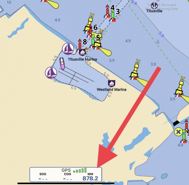
Solution: Aqua Map has now added mile marker displays of the ICW and major rivers in the U.S. based on your GPS location. The MM number appears next to your GPS status at the bottom of the screen (see Fig. 1) to the nearest tenth of a mile.
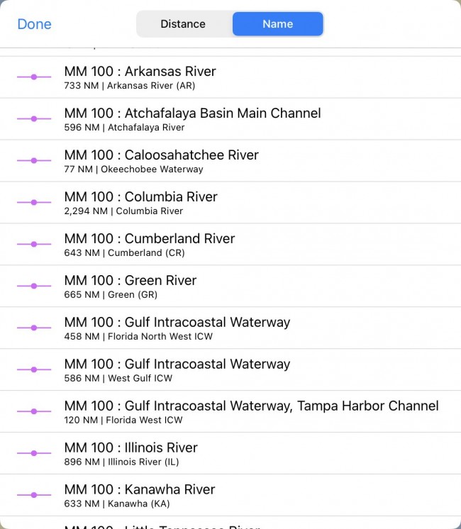
You can also use the search function to input an arbitrary location (941.5 miles, for example) and Aqua Map will pan to that exact location for the ICW and for major rivers such as the Mississippi, Ohio, Caloosahatchee, Columbia, Arkansas and many others. This is a great time saver when looking for anchorages and facilities by mile marker.
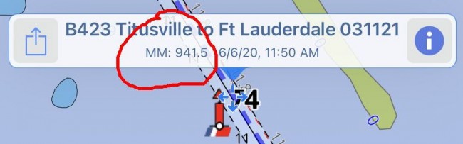
As an added feature, if you tap anywhere along the ICW channel, a text box pops up showing the mile marker number for that location (see Fig 3), so simple.
So there’s no more tapping or dragging the chart along the channel to find the nearest mile marker or trying to use the distance ruler to approximate the twisting and curving ICW to find your exact location. The distance algorithm used by Aqua Map follows the curves of the ICW to give a true mile marker location.
This feature is available now for the Apple version of Aqua Map and the Android version will be updated soon. It’s nice to have technology work for you so you can spend more time relaxing with a drink in hand at the end of the day, enjoying the sunset – unless the weather forecast is wrong about that, too.


- 4,000 Marinas
- Thousands of anchorages
- Updated Charts
- Mile-by-Mile Navigation
- Highlighted Alerts & Cautions
- Full-Color Aerial Photographs

The Waterway Guide App Makes it easy to leave reviews, use our explorer, and view waterway guide materials all on the go!