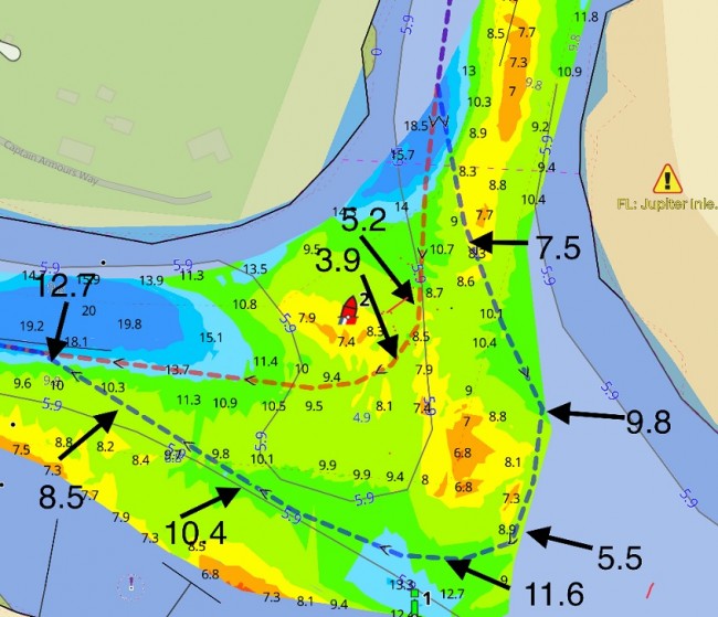
The ICW crossing at Jupiter Inlet has shoaled to 3.9 MLLW by R2. The chart from Aqua Map shows the path of a boat on 3/2/2023 that attempted to follow the red dotted line but grounded when reading 3.9 MLLW where the 4/4/2022 USACE survey (shown) showed 8.5 MLLW.
A path for 5.5 MLLW was found by swinging wide around R2, about 350 to 400 feet off shown by the blue dotted line with MLLW readings along the way. The Coast Guard has been notified of the shoaling and a new USACE survey has been requested.
There is dredging in the area but it's confined to the mouth of the inlet. The ICW area is not scheduled to be dredged so we are going to have this shoaling with us for a while. Great care must be taken in transiting the area due to boat traffic crossing the ICW on the way out the inlet.
The GPX Bob423 track for the area is shown as the blue dotted line. It can be downloaded at
http://bobicw.blogspot.com/p/bob423-long-tracks.html


- 4,000 Marinas
- Thousands of anchorages
- Updated Charts
- Mile-by-Mile Navigation
- Highlighted Alerts & Cautions
- Full-Color Aerial Photographs

The Waterway Guide App Makes it easy to leave reviews, use our explorer, and view waterway guide materials all on the go!